Catalog Archive
Auction 140, Lot 555

"Dieppe, Ville de Normandie au Pais de Caux Port de Mer …", Fer, Nicolas de

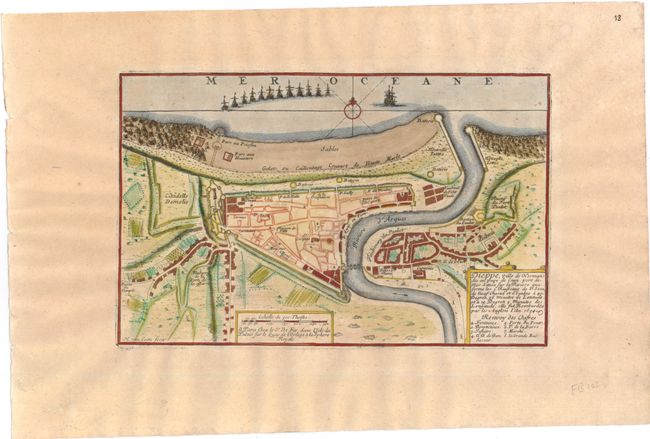
Subject: Dieppe, France

Period: 1696 (circa)

Publication: Les Forces de l' Europe…

Color: Hand Color

Size:
11 x 7 inches
27.9 x 17.8 cm
Download High Resolution Image
(or just click on image to launch the Zoom viewer)

Handsome, detailed plan of the extensive fortifications at Dieppe on the Normandy coast. A fleet of ships is shown and the map is decorated with a compass rose and simple title cartouche that mentions the British bombardment of the town in 1694. Engraved by Herman van Loon and published by Nicolas de Fer, Geographer at Louis XIV's court. He was one of the most prolific publishers of plans of European cities in the late seventeenth century.

References:

Condition: B+

Wide margins with light toning and a small spot near center.

Estimate: $55 - $75

Sold for: $40

Closed on 5/23/2012

Archived