Catalog Archive
Auction 140, Lot 36

"Terre Suivant la Projection de Mercator, et Conforme a l'Etat Actuel des Connaissances Geographiques", Andriveau-Goujon, J.
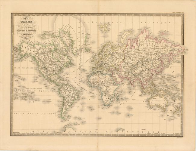
Subject: World

Period: 1836 (dated)

Publication: Atlas Universel

Color: Hand Color

Size:
23 x 16.5 inches
58.4 x 41.9 cm
Download High Resolution Image
(or just click on image to launch the Zoom viewer)

This map of the world on Mercator's Projection is filled with place names and topographical details. The coastal regions in the Polar and Antarctic regions are largely uncharted. Alaska is named Amerique Russe. The map is adorned with an attractive swash letter title and a keyboard-style border. Engraved by P. Rousset.

References: cf. Phillips (Atlases) #791.

Condition: B+

Original outline color and wide margins with faint offsetting and light toning along centerfold.

Estimate: $120 - $150

Sold for: $90

Closed on 5/23/2012

Archived