Catalog Archive
Auction 140, Lot 323

"Harper's Ferry Prepared by Bvt. Brig. Gen'l. N. Michler…", U.S. War Department

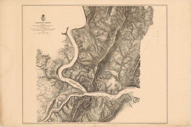
Subject: West Virginia

Period: 1867 (dated)

Publication:

Color: Black & White

Size:
27.3 x 22.5 inches
69.3 x 57.2 cm
Download High Resolution Image
(or just click on image to launch the Zoom viewer)

The skillful use of hachure dramatizes the terrain at the intersection of the Potomac and Shenandoah Rivers at Harpers Ferry, West Virginia. The map is centered on Fort Duncan and Stone Fort which are printed in blue and indicates the names of residents, railroads, roads and terrain features.

References: Stephenson #697.6

Condition: B+

There is some light even toning and a damp stain in the left blank margin, else very good.

Estimate: $250 - $300

Unsold

Closed on 5/23/2012

Archived