Catalog Archive
Auction 140, Lot 32

"A General Chart on Mercator's Projection, to Shew the Track of the Lion and Hindostan from England to the Gulph of Pekin in China, … also the Limits of the Chinese Empire, as Extended by the Conquests of the Present Emperor Tchien-Lung.", Barrow, John (Sir)

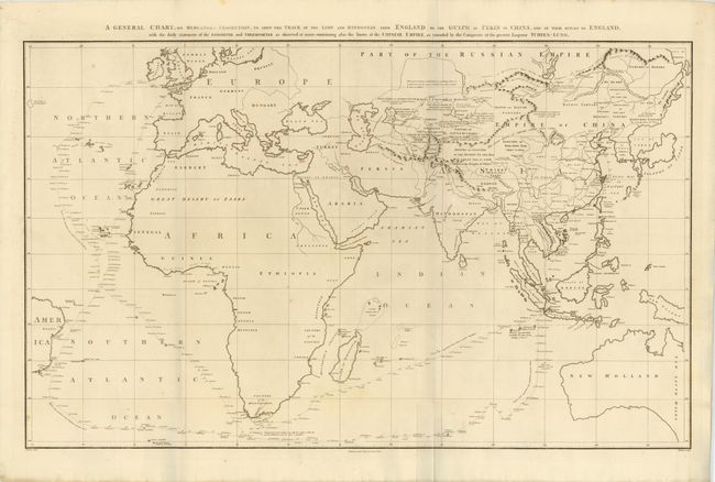
Subject: Eastern Hemisphere

Period: 1796 (dated)

Publication: An Authentic Account of an Embassy from the King of Great Britain…

Color: Black & White

Size:
36.5 x 23.5 inches
92.7 x 59.7 cm
Download High Resolution Image
(or just click on image to launch the Zoom viewer)

This large chart was part of an account of George Macartney's travels to China. Macartney was Britain's first envoy to China, and was tasked with convincing emperor Emperor Qianlong to ease restrictions on trade between Great Britain and China by allowing the British to have a permanent embassy in the country.

The map shows the track of two ships, the Lion and Hindostan, on their routes from England to China and back. Each day's progress was recorded along the route along with several notations to the dangers along the way. The map was drawn by John Barrow, who was the private secretary to Lord Macartney. He was later Secretary to the Admiralty and was a vice-president and founding member of the Royal Geographical Society. Published by George Nicol.

References:

Condition: A

Nice impression on thick, watermarked paper with a few tiny spots, else fine.

Estimate: $400 - $500

Sold for: $550

Closed on 5/23/2012

Archived