Catalog Archive
Auction 140, Lot 280

"Map of New York I. With the Adjacent Rocks and Other Remarkable Parts of Hell-Gate", Kitchin, Thomas

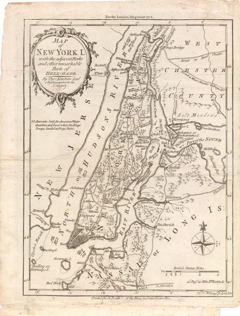
Subject: New York City, New York

Period: 1778 (dated)

Publication: London Magazine

Color: Black & White

Size:
7.3 x 9.5 inches
18.5 x 24.1 cm
Download High Resolution Image
(or just click on image to launch the Zoom viewer)

This small Revolutionary War map shows the area around Manhattan Island, western Long Island, and part of Westchester County subsequent to the British taking control in 1776. There is good detail of roads, towns and barracks. Hell Gate, a narrow tidal strait in the East River, is featured on the map with illustrations of the treacherous rocks and water currents in the area.

References: Jolly #LOND-322.

Condition: B

Issued folding, with an archivally repaired tear that extends 2.25" into map image at left, a few faint spots of soiling, and some extraneous creasing. There is a small abrasion in bottom blank margin with minute loss of publisher's imprint.

Estimate: $200 - $240

Sold for: $160

Closed on 5/23/2012

Archived