Subject: Mississippi
Period: 1823 (circa)
Publication: A General Atlas…
Color: Hand Color
Size:
9 x 11.8 inches
22.9 x 30 cm
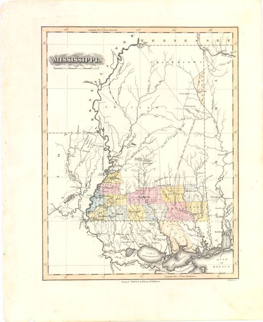
This is one of the rarest early atlas maps of Mississippi, which was admitted to the Union in December 1817. County lines are up-to-date for 1821, with the recent organization of Perry and Monroe counties and an early view of Hinds county (Hynes), which was ceded from the Choctaw Lands by the Treaty of Doak's Stand. The majority of the state is dominated by the Chicksaws and Choctaws lands, the latter of which is separated from the southern counties by the Choctaw Line. There is good detail of roads and rivers throughout the state. Lucas' General Atlas is known as one of the finest general atlases produced in the U.S. at the time, due to the high quality paper, superior engraving quality, and attractive coloring style. Engraved by B. T. Welch.
References: Phillips (Atlases) #742-68.
Condition: A
Original color with wide margins and a faint spot in Marion county.