Subject: Oahu, Hawaii
Period: 1881 (dated)
Publication:
Color: Printed Color
Size:
34.8 x 26.5 inches
88.4 x 67.3 cm
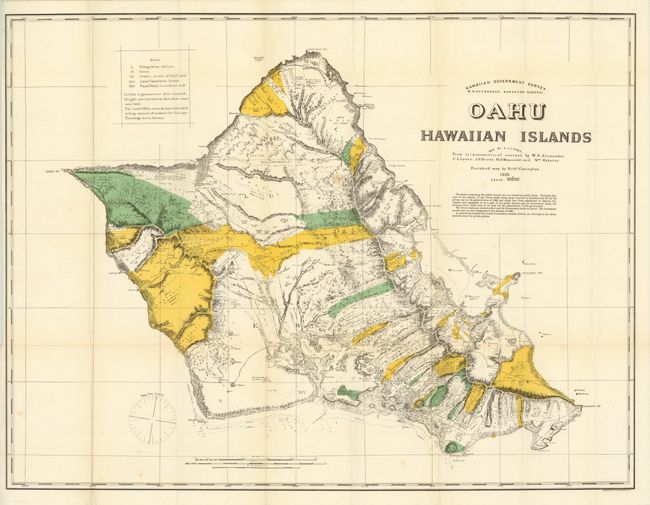
This large, detailed and attractively colored lithographic map was produced 17 years before the U.S. annexation of Hawaii in 1898. It shows the various Crown lands reserved for Kamehameha III (colored yellow) which were transferred by descent, conveyance, and legislation to the public domain as designated in the division of 1848. Government lands are shown in green. Relief is shown by hachure with towns, churches, roads and trails noted. Surveyed by W.D. Alexander. This is one of the first maps published by the Hawaiian Government Survey, which was established in 1878. A reduced version of this map appears in the 1883 U.S. Geological Survey.
References:
Condition: B+
Issued folding with a few tiny spots in the image, one tiny split at a fold intersection, and a narrow, but adequate, left margin.