Subject: World
Period: 1714 (circa)
Publication:
Color: Hand Color
Size:
18 x 14 inches
45.7 x 35.6 cm
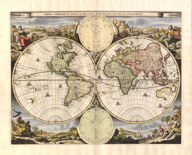
This decorative double hemisphere world map was issued in a Dutch Bible published by the Keur family. It is based on Visscher's Bible map of 1663 and is surrounded by nearly identical engravings, which include numerous exotic animals and four female allegorical representations of the continents. At the top and bottom are two diagrams depicting the Copernican and Ptolemaic theories of the solar system. California is depicted as an island with a flat northern coast. Australia includes the western and northern coasts and the discoveries of Van Diemen. There are numerous Pacific islands including much of the western coastline of New Zealand. Dutch text on verso.
References: Shirley #498; Poortman & Augusteijn #130 (GII-2).
Condition: B
Ample margins and lovely color with a tiny hole in the mountains at top right due to a paper flaw. There are separations and tiny abrasions along the centerfold that have been archivally repaired with minute loss of image.