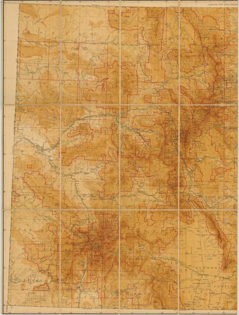
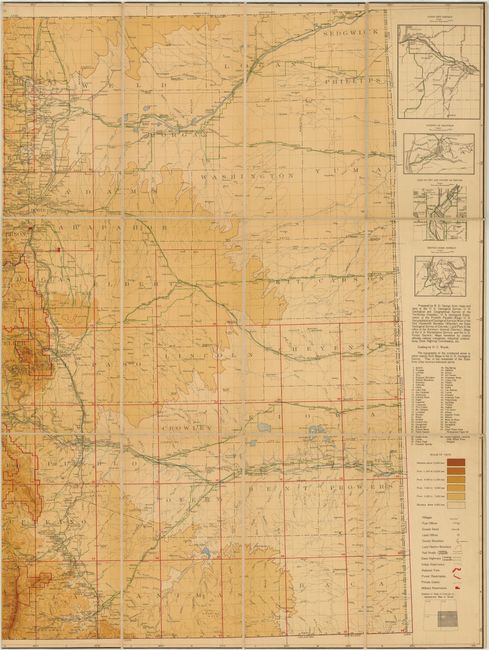
Subject: Colorado
Period: 1913 (dated)
Publication:
Color: Printed Color
Size:
51 x 36.5 inches
129.5 x 92.7 cm
This large-format map shows remarkable topographical detail of Colorado. The color scheme indicates elevation level, with the darkest shade indicating levels over 13,000 feet. In addition to the topography, the map locates post offices, land offices, roads, railroads and Indian reservations. At right are insets of the Carson City district, Leadville, Denver and Cripple Creek. The map was prepared by Russell George of the Colorado State Geological Survey, based largely on data from the U.S. Geological Survey. Dissected and backed with linen with title on verso, as issued.
References:
Condition: B+
Light toning and minor soiling. Trimmed to neatline at top and bottom, as issued.