Subject: Florida, Georgia
Period: 1845 (dated)
Publication: Hand Atlas
Color: Hand Color
Size:
11.5 x 14.5 inches
29.2 x 36.8 cm
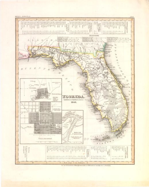
A. Florida. Nach den besten Quellen bearbeitet. This is an interesting map of the state of Florida based on the important Mitchell series showing towns, forts, roads, canals, major rivers and lakes. There are references to forts, battlefields, and routes used by the Army during the Seminole War. There are also three inset maps detailing Pensacola, Tallahassee, and St. Augustine. Water routes from St. Augustine and Pensacola to various ports are described along the upper and lower margins.
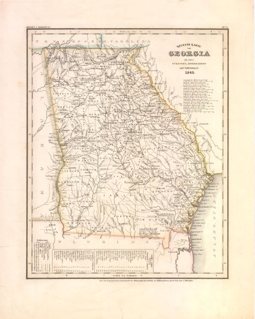
B. Neueste Karte von Georgia mit seimen Strassen, Eisenbahnen und Entsernungen. This is the German edition of the Tanner/Mitchell Georgia map from the New Universal Atlas, with a German title but using English place names. Along the bottom of the map are the steamboat routes from Savannah to Augusta and Charleston (here spelled Carleston). The map shows early county development along with gold mines, canals, trails, roads and railroads. It has a remarkable twelve distance scales.
References:
Condition: B+
<I>Florida</I> has a few faint spots with light toning along sheet edges <I>Georgia</I> is lightly toned with a few edge tears confined to the blank margins that are closed on verso with archival tape.