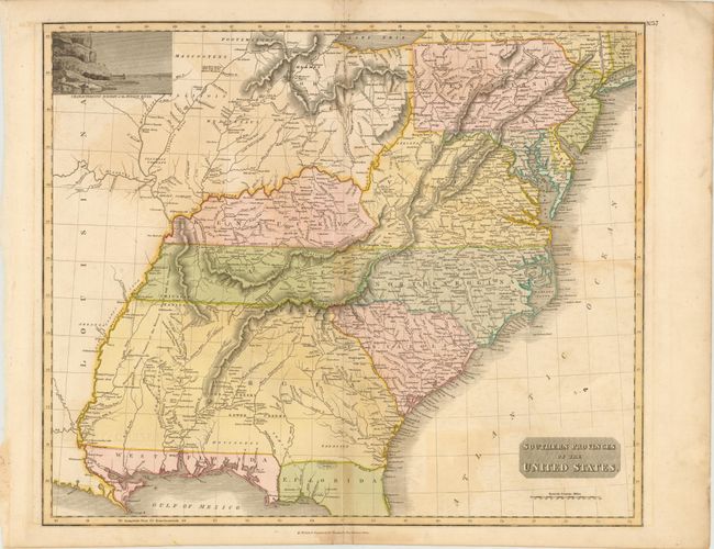
Subject: Southeast United States
Period: 1817 (published)
Publication: A New General Atlas
Color: Hand Color
Size:
23.3 x 19.5 inches
59.2 x 49.5 cm
This finely engraved, large map covers a much broader region than indicated by the title, including the states and territories east of the Mississippi River to the Atlantic and as far north as Lake Erie and eastern Connecticut. The focus of the map however is the southern region with a huge Georgia incorporating today's Alabama and Mississippi. The only settlements shown in this immense territory are located along the Savannah River and the Atlantic Ocean. The balance of the territory is shown under the control of Native Americans with numerous villages, hunting grounds and a few scattered forts located. The area north of the Ohio River also appears to be unorganized except for a few forts. There are also several peculiar mountain ranges shown in this region. There is a scenic vignette of the Hudson River in the top left corner.
References:
Condition: B
There is a centerfold separation that enters 3" into map at bottom and a separation at top that just passes the neatline. Light offsetting, centerfold toning, and a few spots.