Subject: Western Hemisphere
Period: 1838 (dated)
Publication:
Color: Hand Color
Size:
15.8 x 22 inches
40.1 x 55.9 cm
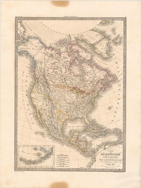
This is an interesting 19th century map of the continent showing the United States in an evolving configuration. The boundary between the United States and Canada reflects the United States claims in the disputed Columbia region (Oregon) and there is an independent Republic of Texas. Alaska is named "Amerique Russe". The map shows good detail of cities, rivers and locations of Indian tribes but does not show state or territorial boundaries. At lower left is an inset of the Aleutian Islands and Bering Sea. Engraved by Pierre Tardieu.
References:
Condition: B+
There are two small fold separations confined to the blank margins that have been repaired with archival tape on verso along with two stains in the top and bottom margin.