Subject: Western Hemisphere
Period: 1643 (published)
Publication: Tresor des Cartes Geographiques
Color: Black & White
Size:
7.5 x 5.5 inches
19.1 x 14 cm
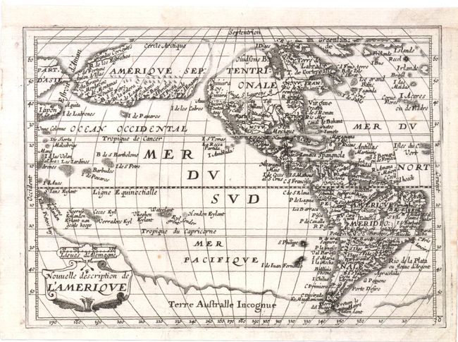
This western hemisphere map is from Boisseau's rare atlas, Tresor des Cartes, which was the first true French world atlas, and was created for the eight-year-old future King Louis XIV. Based largely on Jansson's map of America from Atlas Minor, 1628, the most dominant feature of the map is the curious depiction of the west coast of North America, which is completely bisected by an unnamed straight (Northwest Passage), possibly derived from reports of Juan de Fuca's disputed voyage. The bulging northwest coast of North America continues another 65 degrees and is separated from Asia by a narrow Estroit d'Anian. These features were derived from the Van den Keere and Plancius globe of 1614. Previous maps had depicted the supposed Northwest Passage through the Strait of Anian. Other interesting features include the St. Lawrence River flowing from a small lake in the West and no Great Lakes.
References: Burden, #262
Condition: A
A small hole has been professionally repaired at right on the Tropic of Capricorn, and a few minute holes remain that are only visible when held to light. Backed with Japanese tissue.