Subject: Exploration and Surveys
Period: 1856 (published)
Publication: Ex. Doc. No. 91, 33d Cong., 2d Sess.
Color: Black & White
Size:
9 x 11.5 inches
22.9 x 29.2 cm
During the 1850s, the U.S. government sponsored an extensive series of expeditions designed to gather information on the vast new territories that had been acquired in western North America. The discovery of gold in California further stimulated westward traffic and heightened the need for a faster and more convenient way to bring the far-flung parts of the country together. In 1853 Congress commissioned the Army's Topographic Bureau to conduct a series of surveys to find a suitable route for a transcontinental railroad. There were six major expeditions; five of them covered the area between the Great Plains and west coast, and the sixth explored the coastal states of California and Oregon. All of these expeditions were accompanied by naturalists and artists to document the landscape, flora and fauna along the route.
The reports, maps and lithographs were published in the 13 volume report "Explorations and Surveys to ascertain the most practicable and economical route for a Railroad from the Mississippi river to the Pacific Ocean."
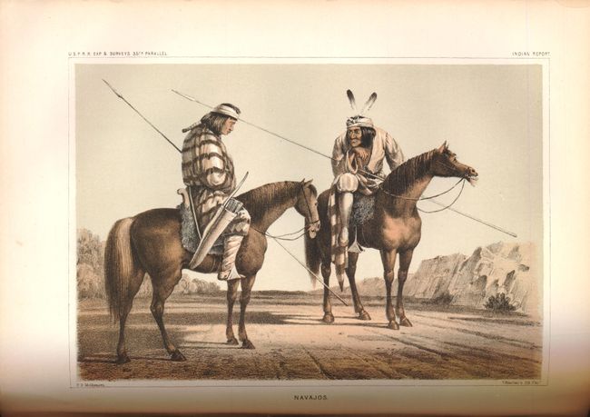
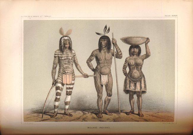
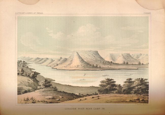
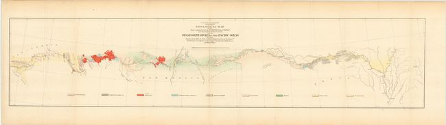
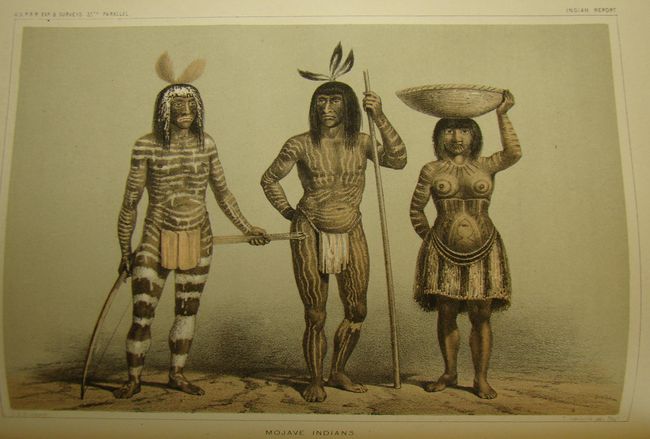
This House of Representatives volume contains the reports of Lt. A. W. Whipple, Corps of Topographical Engineers, regarding his explorations and discoveries along the 35th parallel. It contains a superb collection of tinted lithographs including the lovely Zuni plate, San Francisco Mountains (Flagstaff), the Mojave Valley, the Mojave Villages, Navajoes (mounted on horseback with spears), plates of weapons, baskets and implements, and the famous Mojave Indians plate showing three heavily tattooed Indians, all by H.B. Mollhausen, the expedition artist. There are approximately 21 tinted plates and several black and white plates including fossils, all full page, plus the colorful, large folding maps: "Geological Section from the Mississippi River to the Pacific Ocean…"; "Geological Map…from the Mississippi River to the Pacific Ocean…"; "Geological Section…from the Mississippi River to the Pacific Ocean"; and one black & white map “From the Coo-Che-To-Pa Pass to the Wahsatch Mountains.” 4to, rebound in brown cloth boards with gilt title on spine.
References:
Condition: B
A number of the plates have some damp staining along with some isolated foxing. The pages are tight and generally clean with some light toning. The maps are generally good with some reinforcements on verso with archival tape, however the Wasatch Mountains map is reinforced with cello. The covers and spine are in excellent condition.