Subject: Minorca, Spain
Period: 1786 (dated)
Publication: Atlas Maritimo de Espana
Color: Hand Color
Size:
31.5 x 22 inches
80 x 55.9 cm
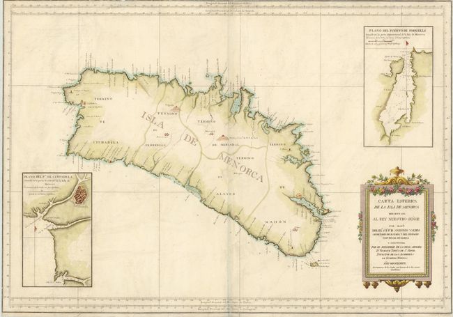
This sea chart of Minorca depicts soundings, coastal names, and fortifications on the island. The map includes two large inset plans of the important harbors of Citutadella and Fornells. A strategic island in the western Mediterranean, Minorca was occupied by the British several times in the 18th century. It was ceded back to Spain at the Treaty of Versailles in 1783. Shortly thereafter, King Charles III of Spain commissioned the hydrographic survey conducted by Admiral Tofino de San Miguel, Director of the Marine Academy at Cadiz. The map is adorned with a decorative title cartouche.
References:
Condition: B
Printed on heavy paper and trimmed to neatline on three sides with some loss of neatline at top. There is minor soiling and a bit of worming along centerfold that has been repaired with archival materials.