Subject: South America
Period: 1622 (published)
Publication: Descripcion de las Indias Occidentalis
Color: Black & White
Size:
11.5 x 8.5 inches
29.2 x 21.6 cm
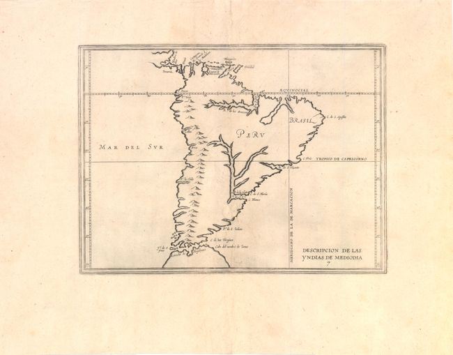
Antonio de Herrera Y Tordelisllas was the official historian of Spain and the Indies. He compiled a history of the Spanish conquests and early explorations in the Americas, which included this simply engraved map of the continent. This rare map is largely derived from the manuscript charts of Juan Lopez de Velasco. The continent is dominated by the huge R. de los Amazona and R. de la Plato and the western mountain range. The Papal Line of Demarcation (Meridiano de la de Marcacion), which divided the non-Christian world between Spain and Portugal, divides the continent between Portugal’s tiny Brazil with the rest (Peru) belonging to Spain.
References: cf. Burden #196.
Condition: B+
Wide margins with a few worm tracks near centerfold that have been professionally repaired with a minute amount of image in facsimile. There is also a tiny tear in a blank area of the Pacific Ocean that has been professionally repaired.