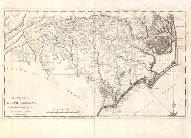
Subject: North Carolina
Period: 1795 (circa)
Publication: Carey’s American Atlas
Color: Black & White
Size:
18.5 x 11 inches
47 x 27.9 cm
This early map displays wagon roads, towns, rivers and mountains, as well as many swampy areas including the Great Dismal Swamp and the Great Green Swamp. Counties are named but the borders are not delineated. The area around present-day Forsyth County is identified with a dotted line, showing the boundaries of the Moravian Community of Wachovia. This is the first state of the map.
Two of the most influential names in American cartography were Samuel Lewis and Mathew Carey. Samuel Lewis was a celebrated draftsman and cartographer who learned his trade from the prominent English cartographer Aaron Arrowsmith. Mathew Carey was a seminal figure in early American publishing; establishing the first publishing firm to specialize in cartography and issuing the first atlas devoted exclusively to American maps. He set up an elaborate cottage system of craftsmen for compiling, engraving, printing, and coloring maps. This practice was emulated by later American cartographic publishers such as John Melish and Henry S. Tanner. The American Atlas concept was also adopted by other publishers in both the United States and Europe.
References: Wheat & Brun #581.
Condition: B+
There is some minor offsetting and staining in the image, and a few edge tears (including one that enters the map border at lower left) that have been repaired and reinforced on verso with archival material. There is a printer's crease in the upper right portion of the image with some light notations in the lower blank margin.