Subject: Maine
Period: 1879 (dated)
Publication:
Color: Hand Color
Size:
13 x 15.5 inches
33 x 39.4 cm
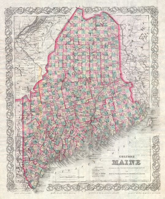
This folding map individually colors each township and depicts roads, towns and villages, rivers, railroads and topography. Printed on fine banknote quality paper, the map is surrounded with Colton's trademark strapwork border. This map originally appeared in Colton's Atlas of the World and was revised for railroad use with time tables for railroads and steamboats on verso. Published for Hoyt, Fogg & Donham, Portland, Maine.
References:
Condition: B+
There is some text show through in the image due to the type of paper used. There is also a stain in the left-center portion of the image where the map was originally adhered to covers.