Subject: Reference Books
Period: 1963-88 (published)
Publication:
Color:
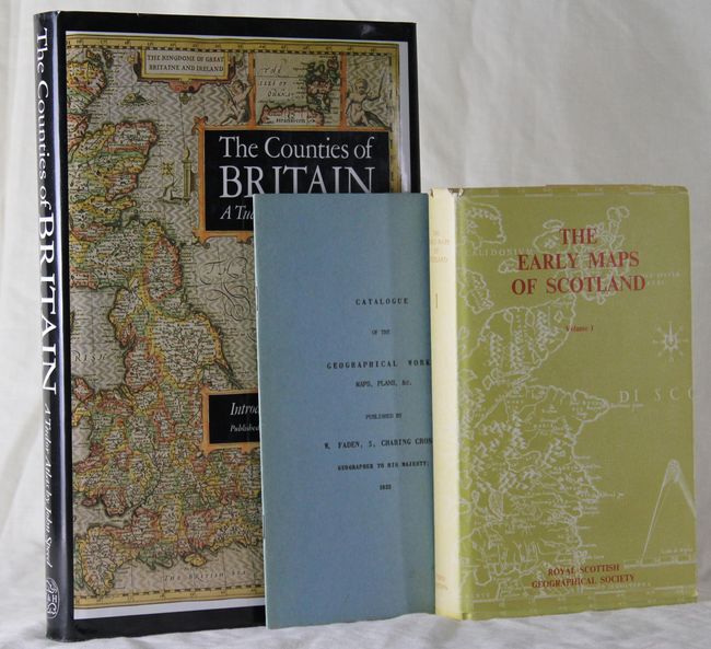
A) The Early Maps of Scotland by the Royal Scottish Geographical Society, published 1973, black & white with color frontispiece, (5.5 x 9"). This is volume 1 which covers maps to 1850. Part 1 covers the history of Scottish maps and part 2 has the map explanation. 243 pp. with 11 illustrations including a colored frontispiece. Hardbound in light green paper boards with paper cover. (A)
B) The Counties of Britain: A Tudor Atlas by John Speed by Nicolson and Hawkyard, published 1988, printed color, (8.3 x 12"). This book includes all 67 maps from Speed's famous atlas along with commentary by Hawkyard. Introduction by Nigel Nicolson. 287 pp. Hardbound in black paper boards and illustrative paper covers. Gilt title on spine. (A)
C) Catalogue of the Geographical Works, Maps, Plans, &c, published 1963, black & white, (5.5 x 8.8"). 16 page booklet of map and plan titles that were published by William Faden in 1822.. Comes with an advertisement from Map Collectors Circle. Paperback. (A)
References:
Condition:
See descriptions.