Subject: Egypt
Period: 1902 (dated)
Publication:
Color: Printed Color
Size:
9.5 x 14.5 inches
24.1 x 36.8 cm
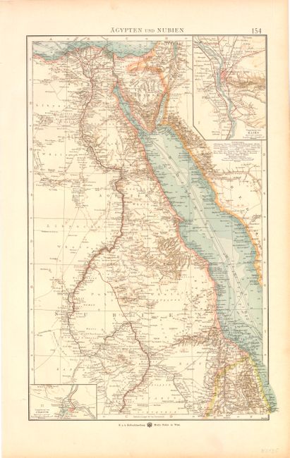
This is a detailed map of Egypt and the Red Sea that extends to include the northern part of modern-day Sudan. It shows the political divisions, topography, settlements and watershed in the area with particular emphasis on the transportation network including the major shipping lanes. The map extends from the Dead Sea in Israel to Khartoum, Sudan. The map has two insets; at upper right is Cairo and at lower left is Khartoum. Published by Moritz Perles.
References:
Condition: A
There is some very minor light even toning, else fine.