Subject: Asia
Period: 1645 (circa)
Publication:
Color: Hand Color
Size:
22 x 16 inches
55.9 x 40.6 cm
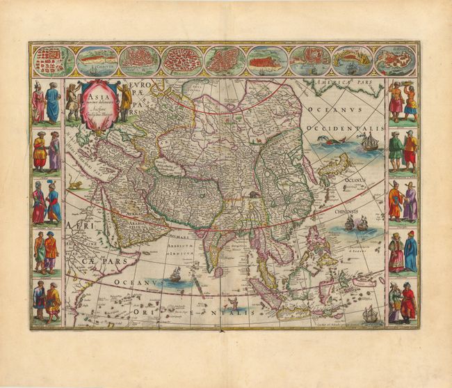
This is one of the most famous 17th century maps of the continent of Asia. It is surrounded in a beautiful carte-a-figures border and is richly ornamented with animals, sea monsters and sailing ships. The eastern coastline of Asia is severely truncated, Korea is shown as an island, and Japan is depicted on the Ortelius-Teixeira model. The Indian subcontinent is too narrow and the islands of Indonesia are very sketchy. A large island labeled Ceiram probably represents the western part of New Guinea. In the interior, the Caspian Sea is oriented on an east-west axis and there are several large erroneous lakes in China including the mythical Chiamay Lacus. The frieze across the top features vignettes of the cities of Candy, Calecut, Goa, Damascus, Jerusalem, Hormuz, Banten, Aden and Macao. The inclusion of Banten reflects the emergence of the Dutch as a major commercial power in the East Indies. The side panels flanking the map depict costumed figures of the various Asian peoples. French text on verso.
References: Walter #25; Yeo #24.
Condition: A
An excellent example with fine color, a dark impression and wide original margins. There is a printer's crease in upper-left corner, and a few barely visible spots along centerfold. Remnants of hinge tape on verso.