Catalog Archive
Auction 138, Lot 644

"Novissima et Accuratissima Totius Russiae vulgo Muscoviae Tabula", Danckerts, Justus
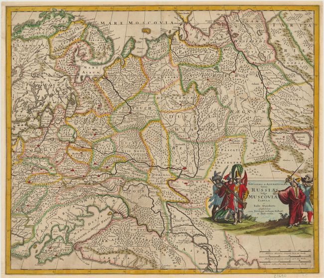
Subject: Russia in Europe

Period: 1690 (circa)

Publication:

Color: Hand Color

Size:
22.5 x 19.3 inches
57.2 x 49 cm
Download High Resolution Image
(or just click on image to launch the Zoom viewer)

This detailed map of western and central Russia extends from Scandinavia and Novaya Zemlya in the north to the Black and Caspian seas in the south. The forests and rivers in the region are prominently featured, including the Volga and Ob Rivers. Numerous place names are also depicted, from large, fortified cities to small towns. The map is adorned with a decorative title cartouche featuring Russian soldiers.

References:

Condition: B

Lovely old color with light soiling. There are numerous notations in old and faded brown ink. Several small tears and cracks have been expertly repaired.

Estimate: $250 - $300

Sold for: $400

Closed on 12/7/2011

Archived