Subject: Eastern Europe
Period: 1780 (circa)
Publication:
Color: Hand Color
Size:
22.5 x 19.3 inches
57.2 x 49 cm
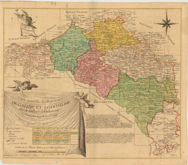
This map of parts of present-day Poland and Ukraine is based on Tobias Conrad Lotter's map from circa 1760. The map describes the Kingdom of Galicia and Lodomeria, which was a crownland of the Habsburg Monarcy that was acquired in the First Partition of Poland. Fortified cities, villages, towns, hamlets, post routes, and post offices are marked on the map, with a French key to the symbols. Probst added text in Latin and German with the results of the 1780 census. In addition, this map is also more decorative than the Lotter version, with the title, scale and key enclosed in a drape-style cartouche displayed by two putti and a secondary Latin cartouche held aloft by the winged angel of Fame.
References:
Condition: B
Original color on watermarked paper, with tiny, scattered old ink spots. There are three small worm holes near centerfold at top, and a small chip in bottom left corner, far from map image.