Subject: Lucerne, Switzerland
Period: 1777 (dated)
Publication: La Borde’s Tableaux Topographiques, Pittoresques, Physiques…
Color: Black & White
Size:
24.3 x 13.3 inches
61.7 x 33.8 cm
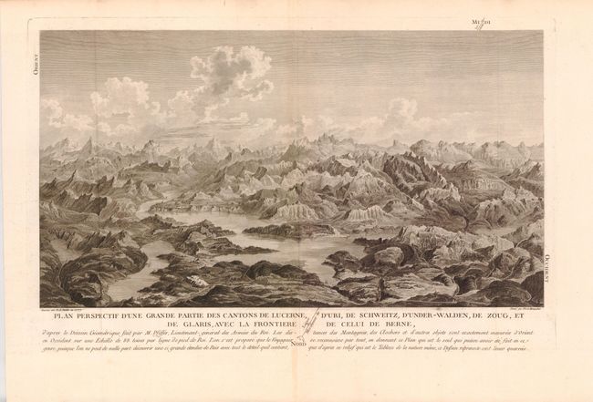
This is a stunning large format view of the central region of Switzerland and Lake Lucerne. This engraving shows fine detail of mountain peaks, lakes and villages sprinkled throughout the valley floor. The note below states that the map is so well drawn that no traveler would get lost. The engraving was taken from the incredible relief map by Franz Ludwig Pfyffer, drawn by Balthasar Anton Dunker and engraved by Francois Denis Nee and Louis-Joseph Masquelier. Pfyffer served as a lieutenant general in the French army where he became acquainted with French terrain modeling techniques. After his retirement in 1769, he returned to Switzerland and began surveying the region around Lake Lucerne. He then created the largest relief model of the Alps ever built. This pioneering work of Swiss cartography is still in existence today.
References:
Condition: A
Nice strong impression with wide margins. There is slight centerfold toning and some very mild soiling in the upper blank margin, else fine.