Subject: World Miscellany
Period: 1780 (circa)
Publication: Atlas de Toutes les Parties Connues du Globe Terrestre
Color: Black & White
Size:
13.5 x 9.3 inches
34.3 x 23.6 cm
This is a lot of 14 maps from Bonne's Atlas de Toutes les Parties Connues du Globe Terrestre . While many regions of the world are included, the emphasis is on islands explored during Captain Cook's third voyage.
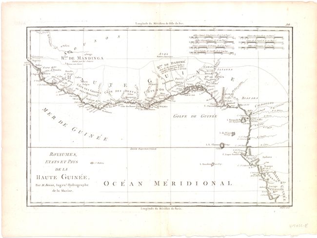
A. Royaumes Etats et Pays de la Haute Guinee. The map extends from Guinea east and south to Gabon with inland detail that is limited to the coastline.
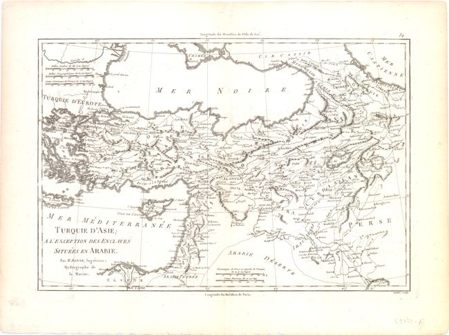
B. Turquie d'Asie. The map covers Turkey east to Iran and south to Egypt with a good amount of inland detail.
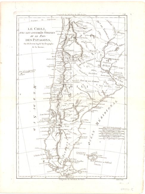
C. Le Chili, avec les Contrees Vorsines et le Pays des Patagons. This map includes most of Chile an Argentina. The Falkland Islands are also shown.
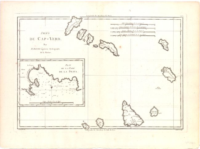
D.Isles du Cap-Verd. The Cape Verde Islands are a group of volcanic islands in the Atlantic Ocean north of the
Equator and west of Africa. The map includes 10 of the larger islands with an inset of Plan de la Rade de la Praya.
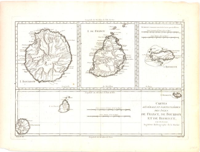
E.Cartes Generale et Particulieres des Isles de France, de Bourbon et de Rodrigue. The Mascarene Islands are a group of three islands in the Indian Ocean south of the Equator and east of Madagascar. Ile de France is now called Mauritius, Ile de Bourbon is now called Reunion and Ile de Rodrigue is now called Rodriguez. Each of the three is shown individually. The geographical relationships of the three are shown in another insert.
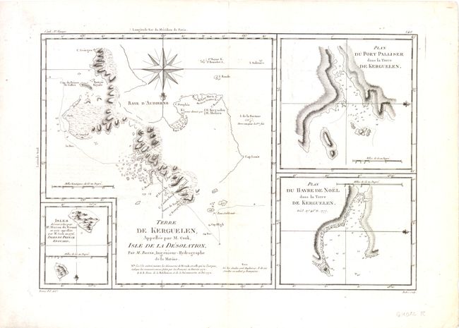
F.Terre de Kerguelen.... The largest chart features the main island of Kerguelen. The group consists of the main island and some 300 smaller islands, reefs and rocks which were discovered by the French navigator Yves de Kerguelen-Trémarec in 1772.
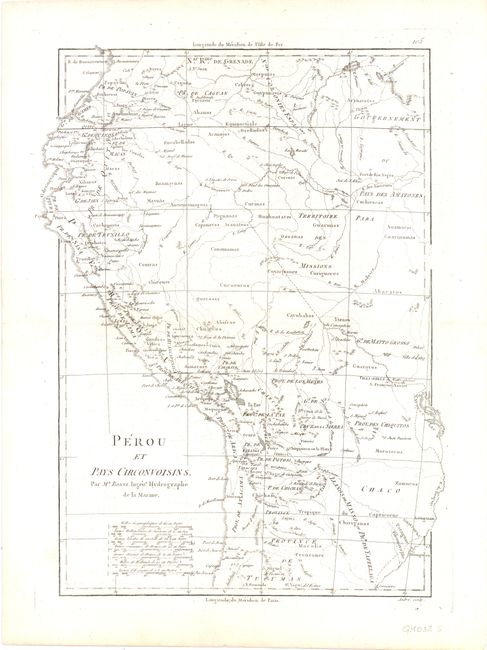
G. Perou et Pays Circonvoisins. This map includes Peru and parts of Ecuador, Columbia, Brazil, Bolivia and Chile.
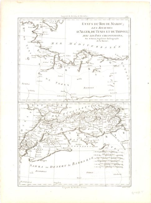
H. Etats du Roi de Maroc Les Royaumes D'Alger, de Tunis et de Tripoli.... There are two maps on the sheet, covering Northern Africa from Morocco to part of Egypt.
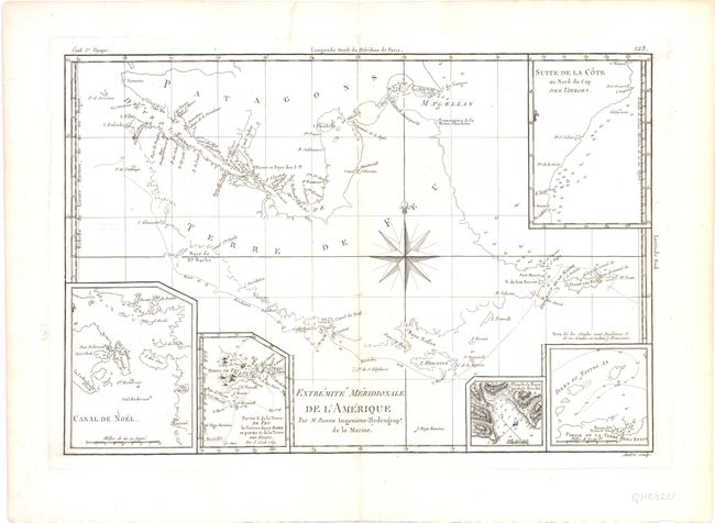
I.Extremite Meridionale de L'Amerique. This map features Terra del Fuego, the Strait of Magellan and parts of Argentina and Chile (then called Patagonia).
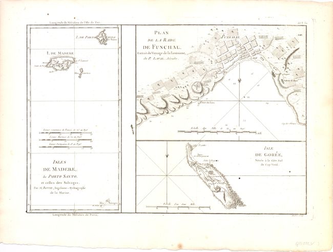
J.Plan de la Rade de Funchal [on sheet with] Isles de Madere de Porto Santo et Celles des Salvages [on sheet with] Isles de Goree .... This map includes Madeira Island with an inset of its capital and chief port, Funchal. Shown, too, is Porto Santo, one of the Madeira Islands.
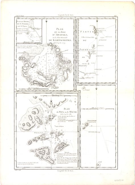
K.Plan de la Baye D' Awatska [on sheet with] Plan du Typa ou de Macao… [on sheet with] Partie du Japon on Nipon. Features a number of different islands during Cook's third voyage including Macao, Kamtschatka and Japan among others.
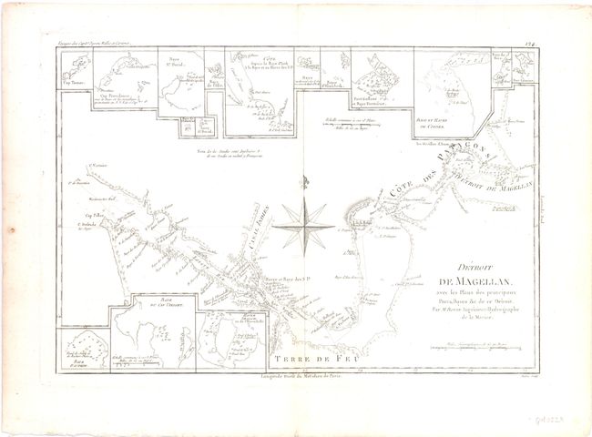
L.Detroit de Magellan. Ferdinand Magellan discovered this strait near the southern tip of South America in 1520 on
his way around the world (he died later while still en route). Above and below the chart are insets of the ports, harbors and bays.
M.Carte des Isles des Amis. This is a detailed map of the Friendly Islands (Tonga) based upon Captain Cook's explorations.
N.Isles Maidenland, de Hawkins, et le Detroit de Fakland. Map of the Falkland Islands with insets of George Island and the Sandwich Islands.
References:
Condition: B+
Overall the maps are very good and good with some light offsetting and toning.