Subject: Stuttgart, Germany
Period: 1871 (circa)
Publication:
Color: Hand Color
Size:
19.5 x 10 inches
49.5 x 25.4 cm
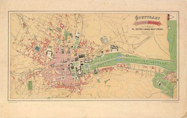
This is a very detailed city plan of Stuttgart, Germany that shows the expansion of the city from 1846 (in pink) to 1871 (in red). Prior to 1846, Stuttgart was considered a small city; it wasn't until 1846, when a train line came into the city, that Stuttgart experienced substantial growth. The map is a fine example of the type of thematic cartography that gained popularity in the latter part of the 19th century. Published by Friedrich Bohnert.
References:
Condition: B+
Light even toning with a few minor spots and a stain at lower right corner of the blank margin.