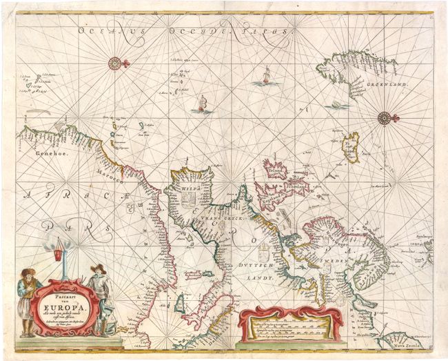
Subject: Europe & Atlantic
Period: 1666 (circa)
Publication: ZeeSpiegel
Color: Hand Color
Size:
20.8 x 16.8 inches
52.8 x 42.7 cm
This handsome sea chart of Europe and the eastern Atlantic extends to include the Africa coast to Cape Verde and nearly all of Greenland. The unusual orientation has north to the right of the chart. It is richly embellished with rhumb lines, compass roses, coats of arms, sailing ships, a distance scale cartouche, and a fine title cartouche. This map is based on Anthonie Jacobsz's map, who was the founder of a flourishing printing and publishing house in Amsterdam.
References: Tooley (MCC-70) #266.
Condition: B+
Watermarked paper with ample margins all around. The short centerfold separations at bottom that have been professionally repaired. There are a few short tears in left blank margin, one of which enters 1/2" into map image, that have also been professionally repaired.