Subject: Europe
Period: 1731 (dated)
Publication:
Color: Hand Color
Size:
28.3 x 19.5 inches
71.9 x 49.5 cm
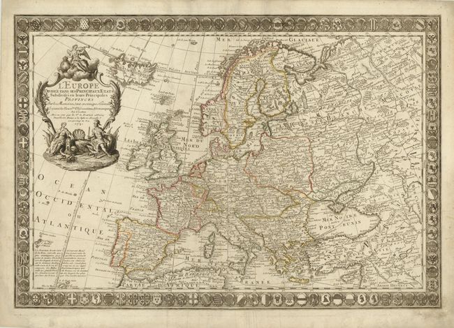
This is one of the most distinctive and decorative maps of Europe from the 18th century. It is surrounded by an intricately engraved border composed of the coats of arms of cities and kingdoms throughout Europe. This map was drawn and engraved by J. Luillier and published by Guillaume Danet, son-in-law of Nicholas de Fer. Danet was not a prolific publisher and his separately issued maps are quite scarce. The map is adorned with a decorative title cartouche with the winged angel of fame sitting atop a cloud and Europa and a soldier surrounded by items representing civilization at bottom.
References:
Condition: B+
Original outline color on watermarked paper with light soiling and an expertly repaired tear that extends 1.25" from the centerfold to Sicily. A long centerfold separation at bottom has also been professionally repaired, and there are some expert paper repairs in blank margins.