Catalog Archive
Auction 138, Lot 464

"La Carte des Conciles / Tabula Geographica Locorum ubi Habita sunt Concilia tam Generalia quam Provincialia, Synodi et Conciliabula", Duval, Pierre
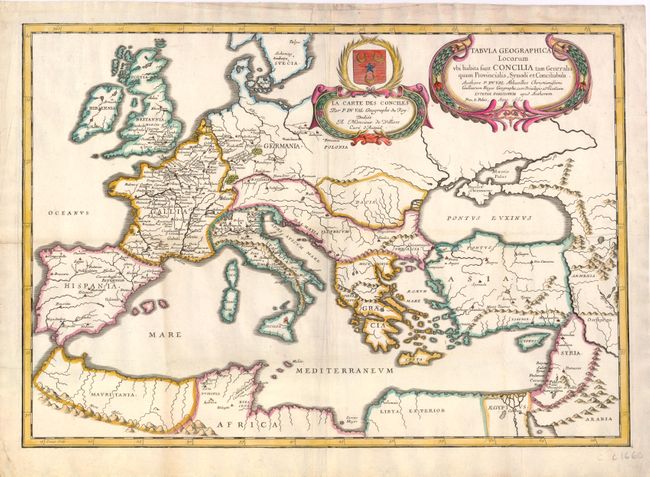
Subject: Europe

Period: 1660 (dated)

Publication:

Color: Hand Color

Size:
21.3 x 14.8 inches
54.1 x 37.6 cm
Download High Resolution Image
(or just click on image to launch the Zoom viewer)

This religious-historical map of Europe extends to include northern Africa and a portion of the Middle East. Locations of general and provincial councils and synods are noted throughout, although most detail is focused in France. The map is adorned with two decorative title cartouches in French and Latin. Engraved by Jean Somer.

References:

Condition: B+

Attractive color on watermarked paper with light-uneven toning and marginal soiling. Minor tears just entering border at left and at top have been professionally repaired.

Estimate: $250 - $350

Sold for: $180

Closed on 12/7/2011

Archived