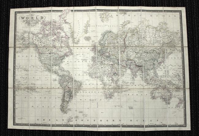
Subject: World
Period: 1870 (circa)
Publication:
Color: Hand Color
Size:
37.5 x 25.3 inches
95.3 x 64.3 cm
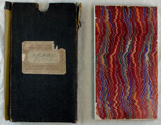
This is a nice large format map of the World. The map is filled with fine detail, especially of the ocean currents. Political boundaries are highlighted in various outline color and there are numerous place names, rivers and lakes highlighted. In North America, Alaska is noted as a U.S. possession, making this map published post 1867. However, West Virginia does not appear as a state (1863), so the map is only partially up-to-date. Dissected into 24 section and backed with linen and folding into a brown slipcase with the original publishers paper label.
References:
Condition: B+
Original outline color. There is some occasional staining and light toning, else very good. The slipcase sides are damaged but it still holds the map.