Catalog Archive
Auction 138, Lot 400

"'T Eyland St. Christofal Geleegen inde West Indies Onder de Caribesse Eylanden…", Keulen, Gerard van

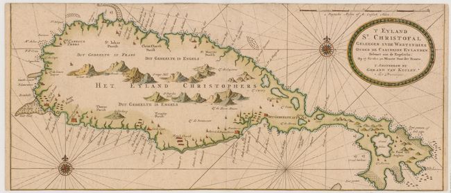
Subject: St. Kitts, Lesser Antilles

Period: 1719 (circa)

Publication:

Color: Hand Color

Size:
23.3 x 10 inches
59.2 x 25.4 cm
Download High Resolution Image
(or just click on image to launch the Zoom viewer)

This is one of the earliest Dutch sea charts specifically devoted to St. Kitts. The map depicts the towns and fortresses along the coastline and only large mountains inland. Anchorages, shoals, rocks are marked all around the island. This map was originally printed on a sheet with a separate map of St. Croix.

References: Tooley (MCC-81) St. Kitts #14.

Condition: B

Printed on heavy, hand-laid paper. The top and bottom margins have been trimmed to the neatline .

Estimate: $425 - $500

Unsold

Closed on 12/7/2011

Archived