Subject: United States, Mexico & Central America
Period: 1828 (dated)
Publication: Stielers Hand Atlas
Color: Hand Color
Size:
14 x 11.5 inches
35.6 x 29.2 cm
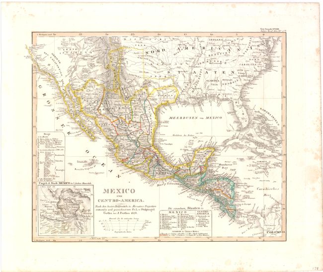
Handsome and finely engraved map that includes portions of central, southern and western United States. Texas is shown as a small Mexican state with its northern boundary ending well south of the Red River. Neu Mexico is a narrow strip of land that follows the Rio Grande del Norte to just north of Taos, naming Santa Fe and Albuquerque. In Neu Californien detail is confined to the coastline, which includes numerous coastal cities and missions including S. Diego, S. Juan [Capistrano], San Carlos del Monterey, and San Francisco. An inset of Mexico City and its lakes is at lower left. Tables list the states and volcanoes of each region. Drawn by Von Stulpnagel.
References:
Condition: A
Wide margins and original outline color with a few light spots confined to blank margins.