Subject: Wyoming
Period: 1877 (dated)
Publication:
Color: Printed Color
Size:
33 x 25.5 inches
83.8 x 64.8 cm
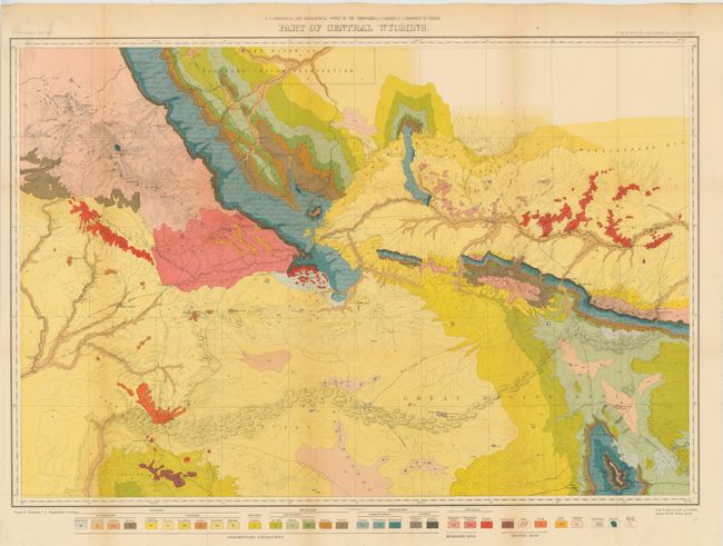
A very detailed map that displays the full course of the Sweetwater River, South Pass, etc. and depicts trails throughout the region. Wheat draws attention to the map's value to students of the Fur Trade and overland emigrant routes. Remarkable detail is shown with contour intervals at 200 feet and a scale of 4 miles = 1 inch. The map extends from part of the Wind River Reservation south to Rawlins. Old wagon roads, trails and the Union Pacific Railroad are featured. A color and pattern code at the bottom provides the key to the 32 different geologic units.
References: Wheat (TMW) #1296.
Condition: B+
Nice bright color with a few repaired fold intersections. Issued folding and now flat and backed with tissue.


