Subject: Utah
Period: 1902-62 (dated)
Publication:
Color:
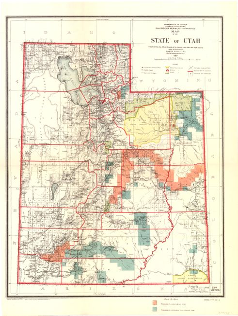
A. Map of the State of Utah by the General Land Office, dated 1902, printed color, (13 x 17"). This is a detailed map compiled under the direction of Harry King, Chief of the Drafting Division, G.L.O. that shows county boundaries, Indian reservations, military reservations, forests and townships. Only about half of the state had been surveyed at this time. The Southern Pacific Railroad route is shown through Promontory, Utah. A few years after this map was made (1902), a cutoff across Salt Lake was completed and the line through Promontory was abandoned. Compiled and drawn by J. Ulke and printed by the Photo-Litho company of Andrew B. Graham. Condition - there are a few small fold separations that have been repaired with archival material on verso, else very good. (B+)
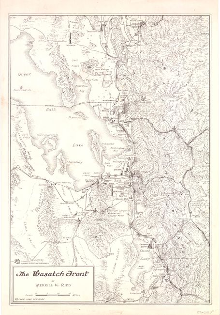
B. The Wasatch Front by Merrill K. Ridd, dated 1962, black & white (10.2 x 14.8"). The map extends from Logan in the north to Provo in the south with most of the Great Salt Lake depicted. This is a very interesting relief map showing major man-made features showing a uranium mill, sugar refineries, weapons depots, Hill Air Force Base, oil refineries, meat packing plants, mines, pipe and steel mills, and even the Thiokol rocket text facilities. (A)
References:
Condition:
See descriptions.