Subject: New York City
Period: 1923 (dated)
Publication:
Color: Printed Color
Size:
40 x 9 inches
101.6 x 22.9 cm
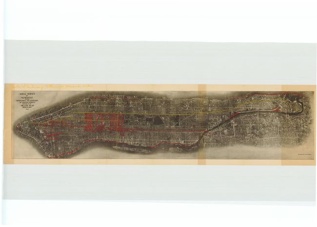
This is a fascinating view of the island of Manhattan from the air. Street routes marked for improvement are shown in red as part of the proposed Miller Plan. Nathan Miller was governor of New York from 1920-1922 and created the New York City Transit Commission, which was created to rehabilitate the ailing transit system in New York City.
Aerial photography started in 1909 by Wilbur Wright, who was marketing planes to the Italian government. Its use, however, took off during World War I and went commercial shortly thereafter. Sherman Fairchild, the creator of this view, designed the camera technology that significantly improved photo quality and became the standard that would be in use for the next 50 years.
References:
Condition: B
There is a small one-inch tear in the lower right portion of the image and some toning on two folds. A previous owner has drawn in yellow proposed subway routes as of December 9, 1924 as noted in the upper left blank margin.