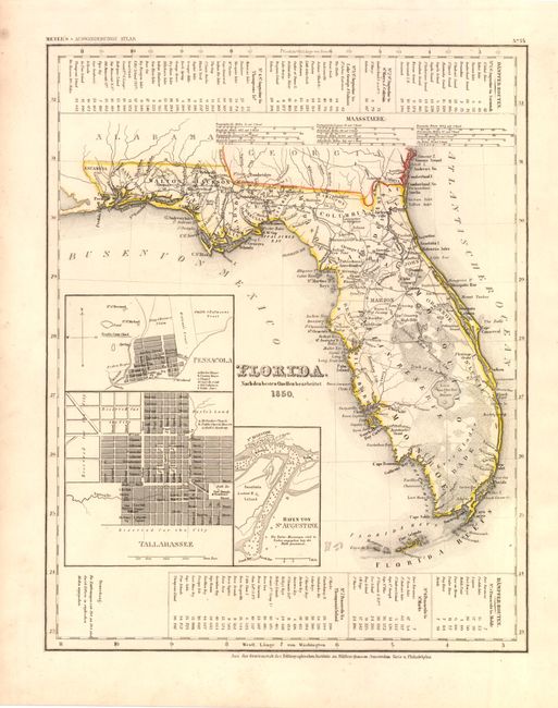
Subject: Florida
Period: 1850 (dated)
Publication: Auswanderungs-Atlas fur Nord Amerika
Color: Hand Color
Size:
11.8 x 14.8 inches
30 x 37.6 cm
This is an interesting map of the state of Florida based on the important Mitchell series showing towns, forts, roads, canals, major rivers and lakes. There are references to forts, battlefields, and routes used by the Army during the Seminole War. There are also three inset maps detailing Pensacola, Tallahassee, and St. Augustine. Water routes from St. Augustine and Pensacola to various ports are described along the upper and lower margins. From Meyer’s Auswanderungs-Atlas (Emigration Atlas), this map was targeted to the large number of German immigrants that flooded into the United States in the aftermath of the March Revolution of 1848.
References:
Condition: A
There is some light even-age toning and a few spots in the blank margin, else very good.