Catalog Archive
Auction 138, Lot 212

"Karte von den Kusten des Franzosischen Florida…", Bellin, Jacques Nicolas

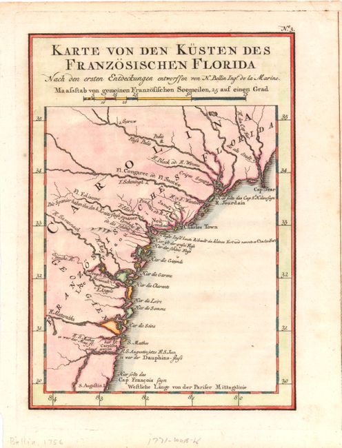
Subject: Colonial Southeast

Period: 1744 (circa)

Publication:

Color: Hand Color

Size:
6 x 8 inches
15.2 x 20.3 cm
Download High Resolution Image
(or just click on image to launch the Zoom viewer)

This uncommon map is from a German edition of Charlevoix's History of New France. It covers the coast from Cape Fear to St. Augustine and shows the locations of Spanish, French and English settlements in the region. There are several errors of location including the misplacement of Jamestown and Charlestown together. A notation (in German) shows the location of Charlesfort that was built by the French explorer, Jean Ribault on Parris Island in South Carolina. It also provides both Ribault's rivers names as well as the contemporary names.

References: Cumming (SE) #259.

Condition: B+

A few faint spots with remnants of hinge tape on verso.

Estimate: $180 - $220

Sold for: $90

Closed on 12/7/2011

Archived