Subject: World
Period: 1620 (published)
Publication: Annales Sacri et Profani
Color: Hand Color
Size:
11 x 6 inches
27.9 x 15.2 cm
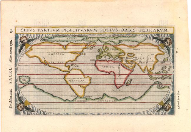
Unusual and delicately engraved world map on an oval projection, from the last edition of Torniello's Annales, which was first published in 1609. This is based on Ortelius' world map of 1570, but is much simplified with very few place names. In the Arctic there are both Northeast and Northwest Passages. North America bears the name of America Mexicana with an unnamed St. Lawrence River stretching far across the continent and no Great Lakes. South America, named Pervviana, has been updated to the more correct shape in this edition. An unnamed Amazon reaches far across South America, nearly reaching the opposite coast. A massive Regionis Antarcticae extends across the southern portion of the world, with only the place name of Beach noted on a portion of what would become Australia, in reference to Marco Polo's writings of his explorations. In Africa, the Nile originates below the equator, but without the Ptolemaic twin lake source. The map is decorated with wind-head spandrels in each corner.
References: cf. Shirley #267.
Condition: A
Lightly toned in blank margins and faint show-through of text on verso.