Subject: Exploration and Surveys
Period: 1841 (dated)
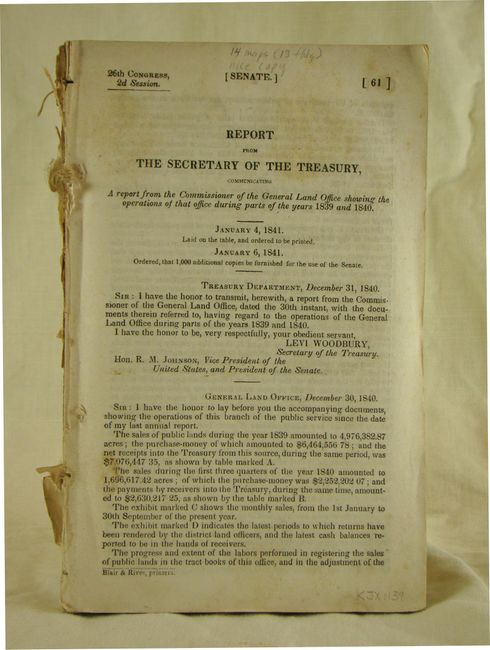
Publication: 26th Congress, 2nd Session, Sen. Doc. 61
Color: Hand Color
Size:
6 x 9 inches
15.2 x 22.9 cm
This informative report includes a statement of public lands sold during 1839 and into 1840, as well as reports from each state's surveyor general. It contains fourteen maps, thirteen of which are folding. Most come with delicate and attractive outline color done by hand. Maps include an untitled map of a portion of the Upper Peninsula of Michigan, and:
Sketch of the Public Surveys in the North Part of Michigan, has attractive outline color to delineate the progress of the survey.
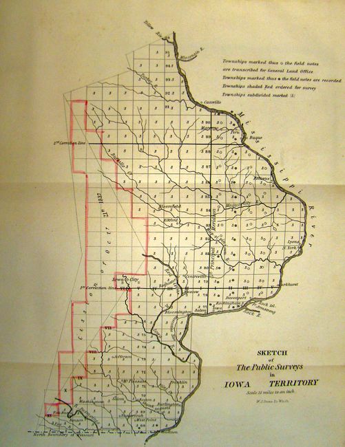
Sketch of the Public Surveys in Iowa Territory, shows part of the Iowa Territory from the north boundary of Mississippi to the Yellow River and from the Mississippi River to a bit west of Iowa City. The map is uncolored, save for some outline color delineating the unsurveyed areas.
Sketch of the Public Surveys in Wisconsin Territory, Surveys extend northwest to the Menomonee River, and recommended surveys run northwesterly along the Mississippi River. Several mills and Indian Reservations are among the details shown.
Diagram of the State of Illinois, locates Chicago, Springfield, Quincy and others. Attractive outline color in several areas.
Diagram of the State of Missouri, is a large map showing the "Old Indian Boundary Line" running parallel to, and south of the northern boundary of the state.
Arkansas, an attractive and uncommon map showing the Old Cherokee Line, and the "Supposed Line Between the United States and Texas".
St. Helena District La., is a small map showing the survey activity this part of the state with outline color to identify surveys under contract, and letters to show completed work.
Map of the District North of Red River La., shows the survey activity this part of the state with color to identify surveys under contract, and letters to show completed work.
South Eastern District Louisiana, shows the survey activity this part of the state with color to identify surveys under contract, and letters to show completed work.
Map of the South Western District Louisiana, shows the survey activity in this part of the state with color to identify surveys under contract, and letters to show completed work.
Diagram of the Surveying District South of Tennessee, is an uncommon and interesting survey map of the region of present-day Mississippi based on work completed by C.A. Bradford in1838 and updated to 1840. It presents the official surveying progress throughout Mississippi, utilizing a series of letters and icons. It shows lands ceded by the Choctaw Indians in 1830, as well as the old tribal boundaries of 1822. The northern boundary is labeled Boundary Line Between the Choctaw and Chickasaw Cessions. Only a handful of towns are identified, such as Jackson, Vicksburg and Columbus.
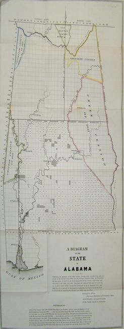
A Diagram of the State of Alabama, shows the cessions of the Choctaw, Chickasaw, Cherokee and Creek tribes.
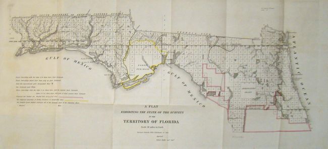
A Plat Exhibiting the State of the Surveys in the Territory of Florida, locates the Forbes Purchase. These maps were printed by W.J. Stone, and show the districts of each state outlined in red. Other details include cities, rivers, land grants and Indian reservations.
Report is 8vo and 137 pp.
References:
Condition: B+
Maps are generally very good with some occasional minor staining and light toning. Pages are mostly clean with some toning. Report is disbound.