Subject: Atlases
Period: 1655 (dated)
Publication:
Color: Hand Color
Size:
14 x 19 inches
35.6 x 48.3 cm
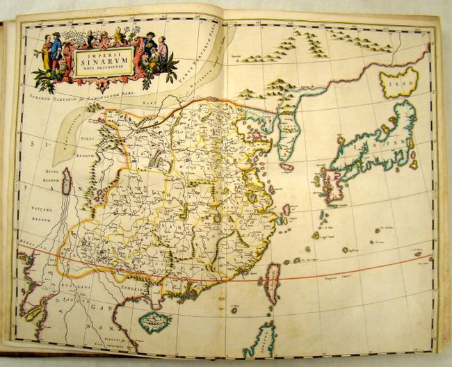
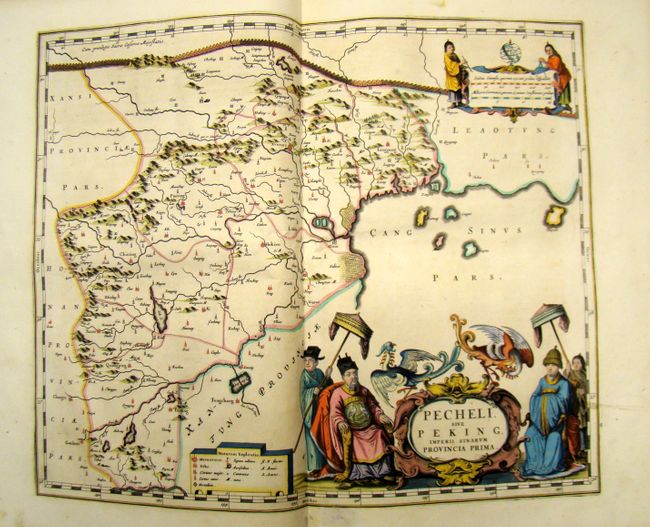
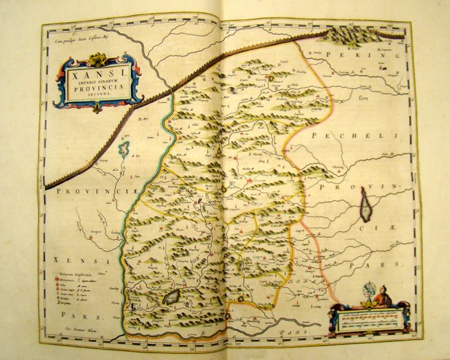
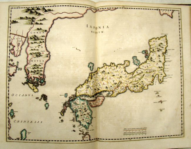
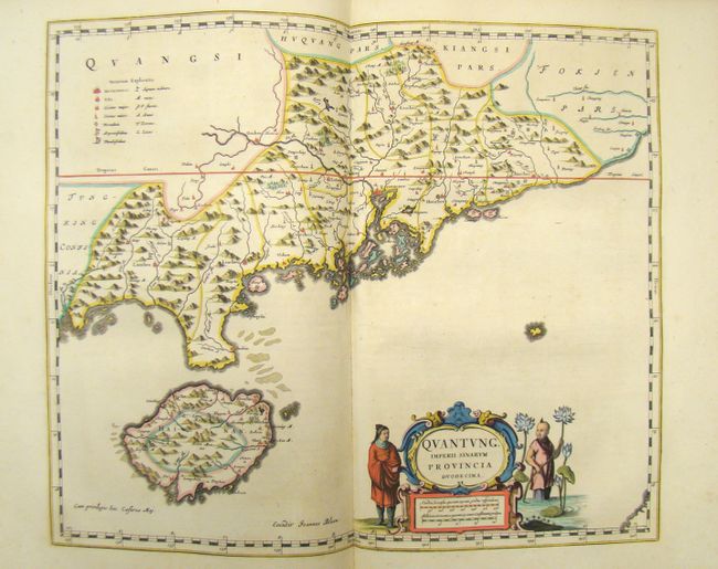
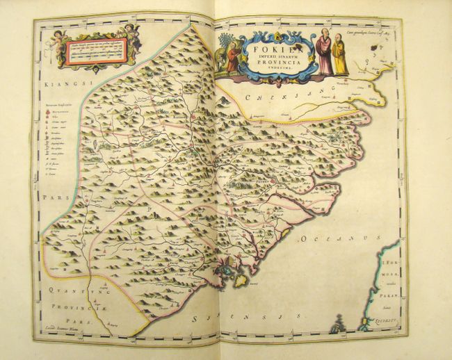
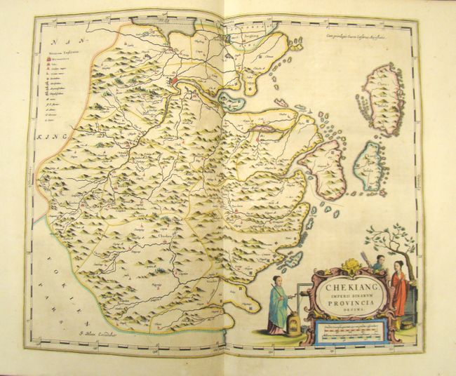
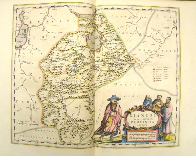
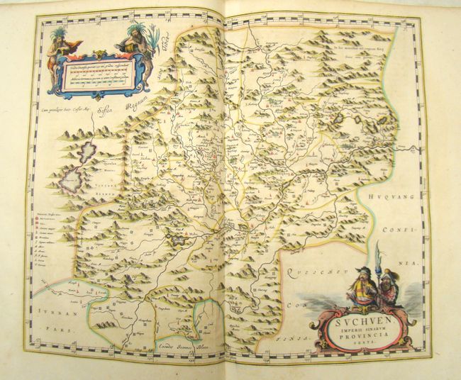
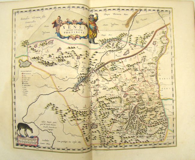
Volume XI of Blaeu's superb atlas is the first western atlas of Asia. This volume is based on the remarkably accurate compilations of the Jesuit Father Martino Martini during his travels between 1643 and 1650. On his return trip to Rome, Martini's ship was blown off course, forcing him to land in Norway. He subsequently made a stop in Amsterdam where he met Johannes Blaeu, and agreed to assist in the production of the Atlas Sinensis. Martini succeeded in producing very accurate maps of Japan, China, and their provinces, which may be attributed to Martini's skill as well as access to Chinese maps during his travels. His maps were copied extensively for the next century. Of particular note, in Imperii Sinarum and Iaponia Regnum, Korea is shown as a peninsula for the first time on a map produced outside of China. The Jesuit missions are indicated throughout the maps by a cross above the letters "IHS." The atlas includes a general map of China, fifteen maps of individual Chinese provinces, and a general map of Japan.
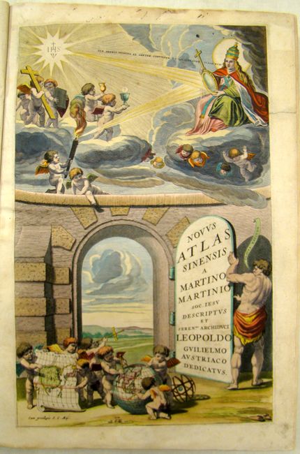
The exquisite title page features the title on the door to an open portal. In the foreground, putti hold a map of China and make measurements on a globe within the continent of Asia. In the skies above an emblem of Jesus Christ (HIS) emits a radiant light that reflects off of a mirror held by the Pope. The reflected beam lights a beacon held by a putto, with other putti above him holding emblems of the Word, including a crucifix, a book (the New Testament), and vessels associate with the Eucharist. A quotation emanating from the Pope's mouth translates as "Go, swift messengers, to a nation powerful but divided" (Isaiah 18.2).
The atlas is complete, with all maps, text pages and title page present. Includes Martini's description in 171 pages, plus 9 dedication pages, 17 maps, 19 pages of tables, 6 index pages, and 33 'additamentum' pages of text about the Manshu War. The dedication page is dated January 7, 1655. Small elephant folio, full mottled calf, spine gilt with raised bands.
References: Shirley, (TP) #53A; Taschen/Krogt #X/12; Goss (Blaeu) p. 210-223.
Condition: A
Plates generally clean and bright with beautiful old color. A few maps have light toning, <i>Imperii Sinarum</i> has a binding trim at bottom with loss of neatline, and the maps of <i>Xensi</i> and <i>Fokein</i> have small ink stains in the map. There is a small amount of insignificant insect damage confined to blank margins. Original covers, rebacked using part of original spine. Moderate toning in text.