Subject: Australia
Period: 1861 (circa)
Publication:
Color: Hand Color
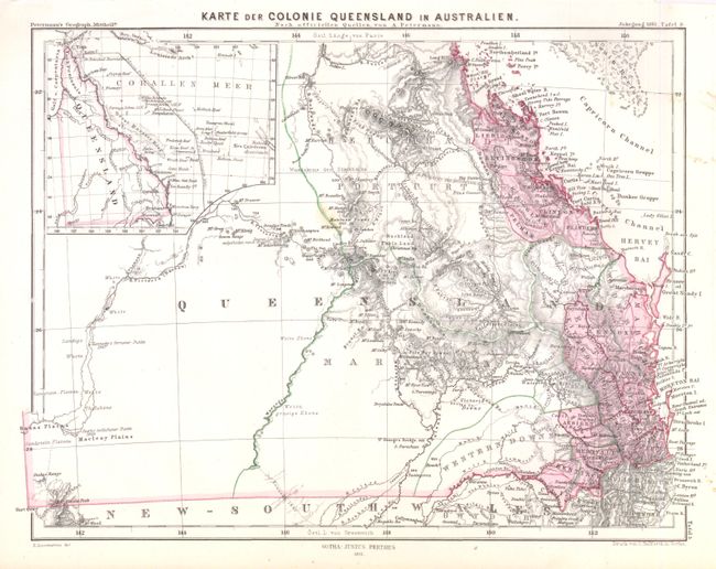
A. Karte der Colonie Queensland in Australien, (9.8 x 7.7"). Map showing the province of Queensland with settlement confined along the eastern seaboard.. There is nice detail of towns, rivers and mountains in hachure. Several early explorations are shown in the interior. Edmund Kennedy’s expedition to discover whether the Victoria River (Barcoo River) flowed into the Gulf of Carpentaria is traced. Augustus Gregory’s expedition in search of the lost explorer Ludwig Leichhardt in 1858 is also shown. The eastern point of Charles Sturt’s expedition to settle the debate concerning the existence of an inland sea is located in the Macleay Plains. There is a small inset at upper-left showing the Great Barrier Reef and the islands off the coast.
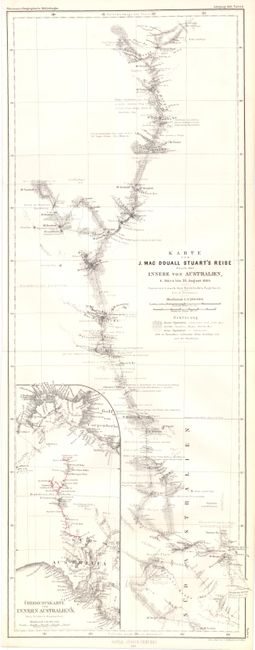
B. Karte von J. Mac Douall Stuart's Reise durch das Innere von Australien…, (7.9 x 20.7"). Rare map showing the journey of John McDouall Stuart, one of Australia's most famous explorers, into the interior. There is detail of place names, vegetation type, relief in hachure and various notations along the route. At lower-left is an inset showing an overview of his journey highlighted in red.
References:
Condition: A
Both maps are in very good condition with faint toning and a few tiny stains in the blank margins. Issued folding.