Subject: China & Korea
Period: 1657 (circa)
Publication:
Color: Hand Color
Size:
20.5 x 18.5 inches
52.1 x 47 cm
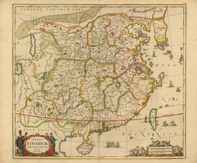
This superb map of the Chinese Empire is drawn largely from the Blaeu map compiled by Jesuit Father Martino Martini who traveled through the region between 1643 and 1650. It deviates from that model in its depiction of the Korea peninsula, which is shown with a cluster of islands at its southern tip. The map is embellished with sailing ships and Chinese junks. The title cartouche is flanked by Chinese and Jesuit men and the scale of miles cartouche is surrounded by putti. Engraved by Johannes van Loon.
References:
Condition: B+
Lovely old color with a few light stains. A centerfold separation that enters map image 4.5" at bottom has been closed on verso with archival tape, and a small tear in left blank margin has been closed on verso with old paper.