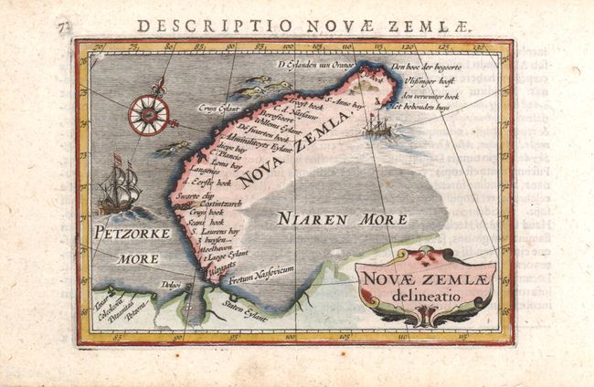
Subject: Novaya Zemlya, Russia
Period: 1616 (circa)
Publication: Tabularum Geographicarum Contractarum
Color: Hand Color
Size:
5.3 x 4 inches
13.5 x 10.2 cm
This charming miniature map shows the parts of Novaya Zemlya that had been discovered by western Europeans during their search for a northern passage to Asia. The first visit was by Hugh Willoughby in 1553. Then in 1596, Willem Barents rounded the north point of Novaya Zemlya, and wintered on the east coast near the northern tip. The map shows the western coast and northern tip of Novaya Zemlya according to Barent's reports, and is decorated with two sailing ships and a raft of penguins in the sea, with a decorative title cartouche and compass rose. Latin text on verso.
References: King (2nd ed.) pp. 80-82.
Condition: A