Subject: Russia in Europe
Period: 1788-90 (dated)
Publication:
Color: Hand Color
Size:
50 x 18.6 inches
127 x 47.2 cm
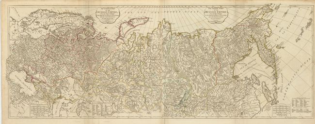
This tremendously detailed map that covers the whole of Russia has been updated to show Russia's new provinces on the Black Sea and information from Capt. Cook's exploration of Kamchatka. The map was first issued in 1772 by Robert Sayer with a conjectural Alaskan Peninsula and an entirely different configuration for Kamchatka. This edition was compiled from the maps of the Imperial Academy at St. Petersburg. Five distance scales and extensive legend explains Russian terms used in the map. The map is printed on two, joined sheets (as issued).
References:
Condition: A
Original outline color with a short fold separation that just enters map border at bottom, and has been repaired on verso with old paper. The map is lightly creased along the folds.