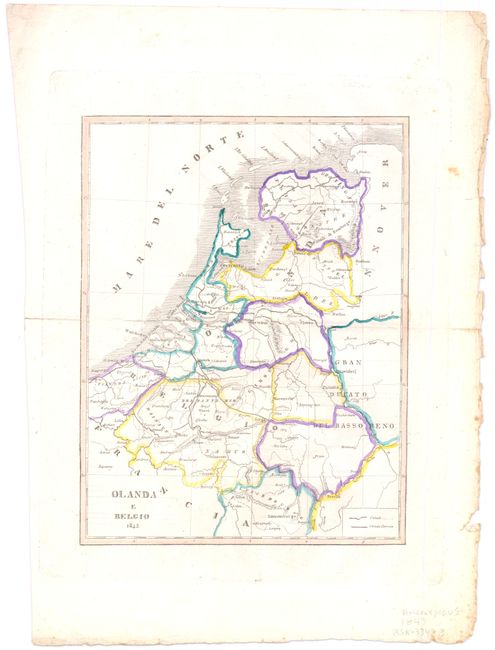
Subject: Low Countries - Railroads
Period: 1843 (dated)
Publication:
Color: Hand Color
Size:
6.8 x 8.9 inches
17.3 x 22.6 cm
The very first railway in continental Europe opened between Brussels and Mechelen (Malines) on May 5, 1835. By 1843, the major east-west/north-south axis was complete in Belgium, connecting Brussels to Liege in the east, Ostend in the west, Antwerp in the north, and Mons in the south. In subsequent years, private companies were allowed to construct and use their own railroad systems, which became a crucial element in the industrialization of Belgium. This interesting small map depicts the railroad system in Belgium and the canals throughout Belgium and the Netherlands in the mid-nineteenth century.
References:
Condition: A
Wide margins with a centerfold separation at left just, which barely touches neatline, and a short centerfold separation at right have both been closed on verso with archival tape. There are a few minute tears in right-hand blank margin.