Subject: Britain
Period: 1745 (published)
Publication: Tindal's Continuation of Mr. Rapin's History of England
Color: Black & White
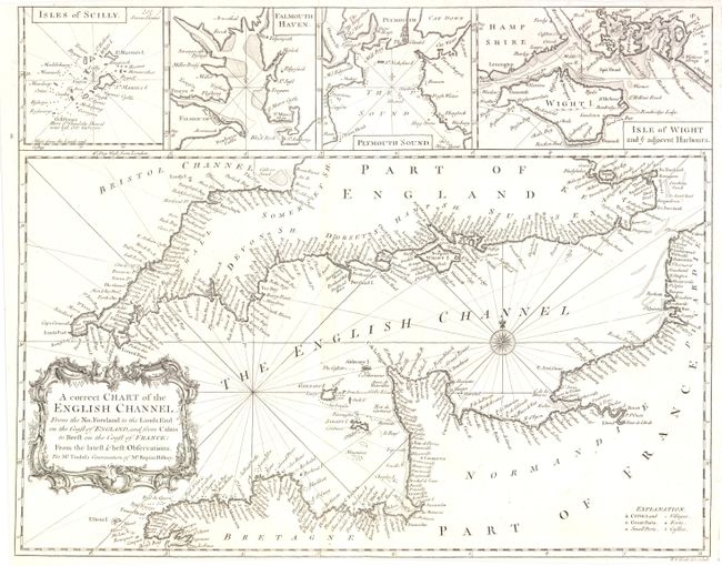
1) A Correct Chart of the English Channel… , (18.8 x 14.8"). A handsome and detailed chart of the English Channel, with a large decorative cartouche and compass rose. The inset maps across the top detail the Island of Scilly, Falmouth Haven, Plymouth Sound and the Isle of Wight and adjacent Harbours. Beautiful impression on clean paper. Close margin at bottom as issued. (A+)
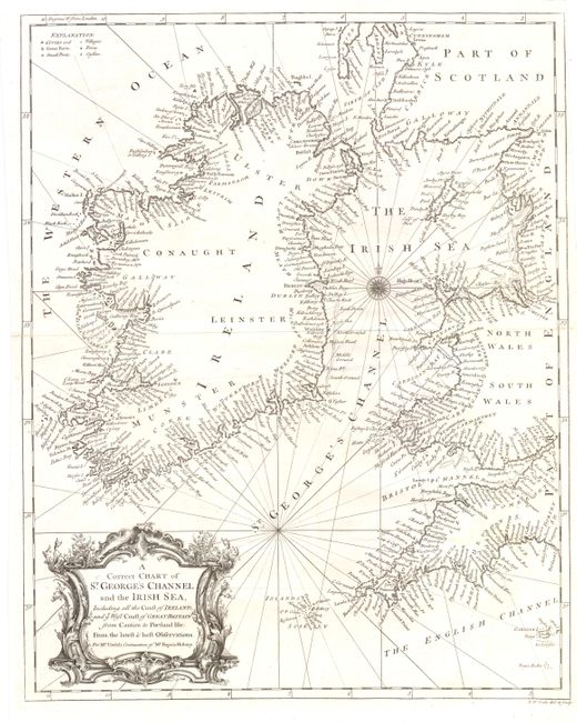
2) A Correct Chart of St. George's Channel and the Irish Sea…, (14.7 x 18.3"). This great sea chart details the entire coastline of Ireland and the western coastal areas of Scotland and England between the Firth of Clyd to Lands End. Includes the Isle of Man and Guernsey Island. Beautifully engraved and with a striking and large title cartouche. Clean and bright with very dark impression. Short splits at either side of center fold well repaired on verso. Close top margin, as issued. (A)
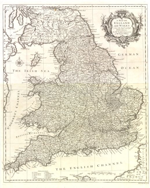
3) A Map of England and Wales, (15 x 18.3"). Exceptional detail and finely engraved throughout. Compass rose and very elaborate title cartouche decorate this handsome chart. On clean paper with dark impression. Short edge split on centerfold at right, well closed on verso. Close right margin as issued. (A)
References:
Condition:
See individual descriptions. Each is uncolored as issued.