Subject: Europe
Period: 1705 (circa)
Publication:
Color: Black & White
Size:
17 x 14.3 inches
43.2 x 36.3 cm
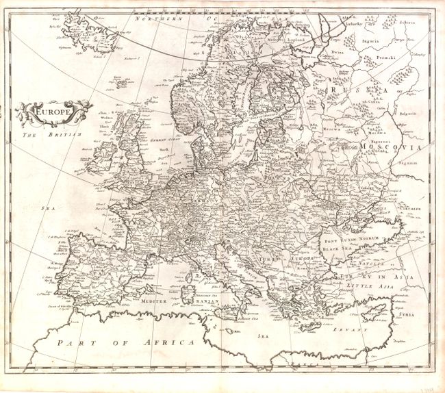
By the 1700s, the geography of Europe was fairly well established, although not precise by any means. Detailed survey by triangulation was yet to come. This map includes Iceland in the upper left, the Northern Ocean (now Arctic Ocean and Barents Sea) at the top, and the entire Mediterranean at the bottom. The map provides a good look at the political entities existing over 300 years ago. Entities found on this map, such as Little Russia, Upper Poland, Lower Poland, and Prussia do not appear on today's maps. However, places like Croatia, Bosnia and Servia (Serbia) can be found.
References:
Condition: B+
Some very light toning and a few small stains, else very good.