Subject: Cuba
Period: 1762 (circa)
Publication:
Color: Hand Color
Size:
19.2 x 13.5 inches
48.8 x 34.3 cm
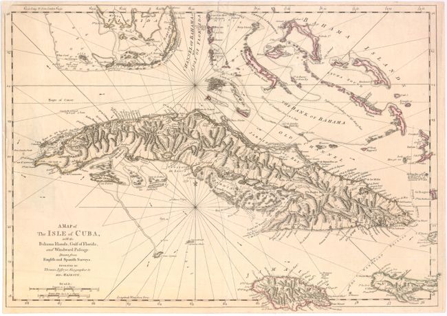
This detailed map of Cuba shows town, villages, mountain ranges, forts, and rivers on the island, as well as soundings, navigational hazards, currents, and routes of navigation in the surrounding waters. Based on English and Spanish surveys, the map extends to the southern tip of Florida in the north, and includes the Bahamas and Jamaica.
Jefferys was the leading English cartographer of the 18th century, serving as both Geographer to the Prince of Wales, and later, Geographer to the King, he had access to the best surveys conducted in America. He published a series of maps of the American colonies that were among the most significant produced in the period, including the Fry/Jefferson map of Virginia, Braddock Meade’s map of New England, and William Scull’s map of Pennsylvania and the western frontier.
References: Sellers & Van Ee #1781; Lowery, W. #463.
Condition: B+
A 2" tear along map border at right has been closed on verso with Japanese tissue and the upper-left corner has been replaced with old paper, with minor loss of neatline.