Subject: Texas
Period: 1920 (dated)
Publication:
Color: Printed Color
Size:
8 x 10 inches
20.3 x 25.4 cm
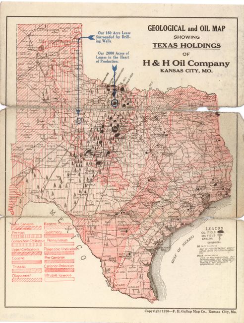
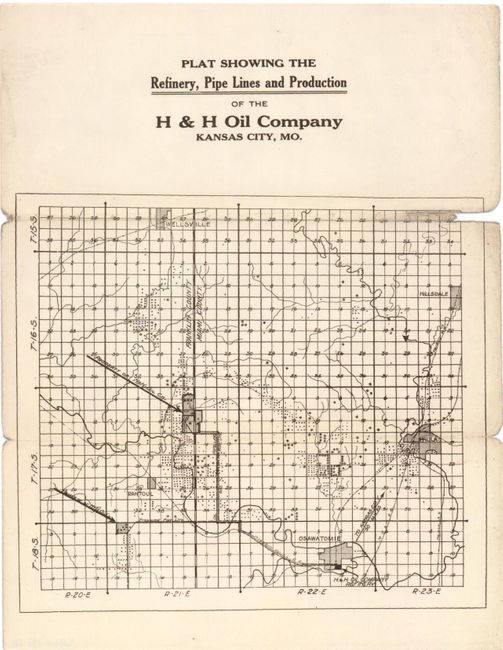
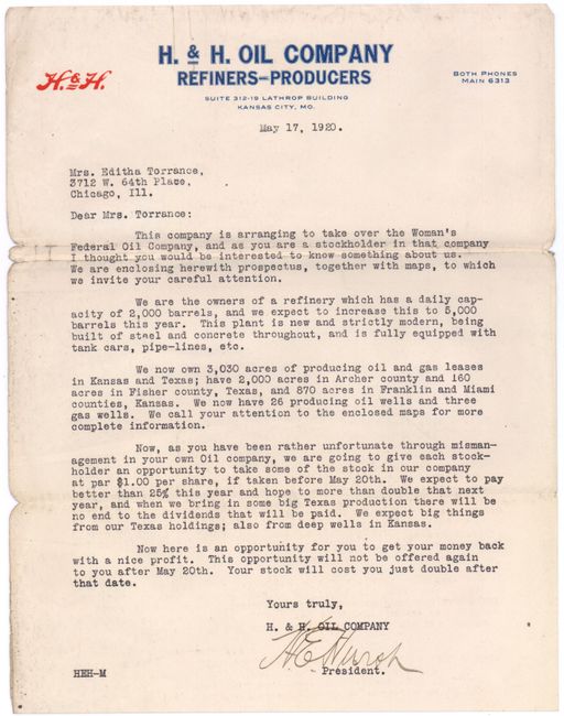
This is a unique set of promotional materials from the H&H Oil Company and focuses on the burgeoning oil and gas business in Texas, often referred to as the Texas Oil Boom or the "Gusher Age". The first item is a Geological and Oil Map Showing Texas Holdings of H&H Oil Company highlighting the company's 2,000 acres in Archer County and 160 acres in Fisher County. The map is filled with detail of oil fields, gas fields and drilling locations each shown with a tiny oil derrick. The map also highlights 14 different geologic formations with a key at lower left. The second map is a Plat Showing The Refinery, Pipe Line and Production of the H & H Oil Company that shows the H&H refinery and future pipeline plans in Kansas. Accompanying the maps is a letter from the president of the H&H Oil Company, dated May 17, 1920, urging a stakeholder to invest in the company. A very intriguing piece of Texas oil history.
References:
Condition: C
There is some loss of map image along the folds in both maps, with some soiling along the right edge. Issued folded.