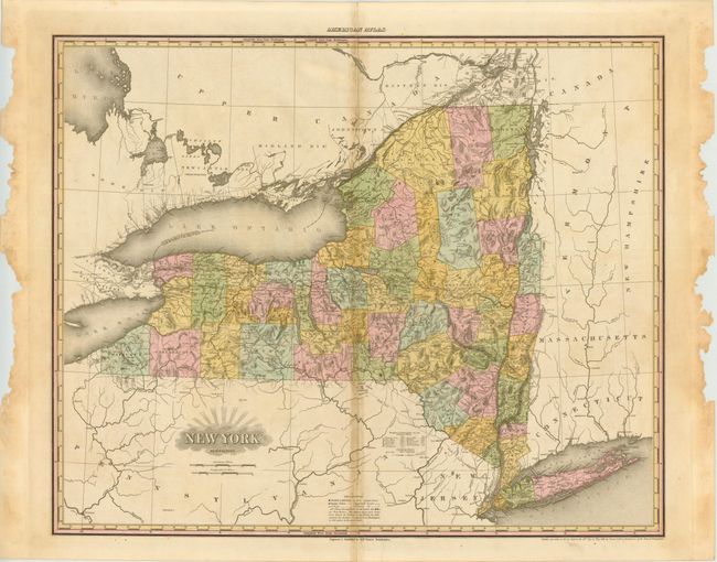
Subject: New York
Period: 1823 (circa)
Publication: A New American Atlas
Color: Hand Color
Size:
26.5 x 21.5 inches
67.3 x 54.6 cm
What is particularly interesting about this map of the state of New York is the development in western New York, one of the first areas of speculation in the United States. The perceived wealth and prosperity of the region led to the creation of the Erie Canal, which opened in 1825 and runs from Albany (Hudson River) west for 363 miles to Buffalo. On this map it is marked "Gr. Canal." The map also provides a great view of the extensive road system with common and important roads distinguished. Tanner’s New American Atlas was first published in parts between 1819 and 1823 with a second edition in 1825. The copyright date on this map is 1819,
References: Ristow, American Maps and Mapmakers, pp.191-198
Condition: B
Strong impression with original color. The centerfold has some toning and slight separations at top and bottom that is confined to the blank margin. The left and right margins are tattered but a full inch away from the image.